
New Bedford Previous Residents by Era
Different records carry an address backward for different spans. Land records provide the title path. Historical directories and census schedules provide dated household evidence. Maps, permits, obituaries, and probate files add physical change, family, or estate context. Start with the source closest to the era in question, then cross-check the address, legal description, and dates before connecting one result to the next.
| Source | Years It Covers | Where Held | What It Shows |
|---|---|---|---|
| Registry recorded-land images | Online back to Book 605; exact year for that book not located | Bristol South Registry search and office | Deeds, mortgages, liens, plans, legal descriptions, and recording dates |
| Old grantor/grantee indexes | 1690 onward in published scanned ranges | Bristol South Registry old-index collection | Older name-chain entries and book references |
| New Bedford directory editions | 1836–1971 with documented gaps | State Library, local library, Internet Archive, and FamilySearch | Dated address, occupation, and household clues, including street sections |
| Massachusetts state census | 1855 and 1865 | Archives, library, and genealogy access channels | Household evidence near a directory edition |
| Federal census | 1790–1950 | NARA, library, and genealogy access channels | Household composition, age, relationship, occupation, and residence at enumeration |
| Sanborn maps | 1888, 1893, and 1906 | Library of Congress | Street setting, building footprint, use, and numbering context |
| Obituary and Probate trail | Obituary index 1968–present; probate coverage varies by file | New Bedford Free Public Library and Probate and Family Court | Death-page clues, relatives, fiduciaries, heirs, and property disposition |
For a recent transfer, begin with the current parcel and Registry image. For an older household question, find the nearest directory edition and census year, then test it against the land trail. A long gap needs supporting plans, Sanborn sheets, newspaper evidence, or a library request, rather than a guessed connection.
Fix the Modern New Bedford Parcel
Use New Bedford AxisGIS to establish the modern starting record. Capture the current address spelling, ZIP, parcel ID, map/lot, displayed owner, mailing address if shown, and any alternate street label. The city guide confirms type-ahead by owner name, street address, or parcel ID, plus a CAI Property Card, map layers, and a search/filter control. The parcel record anchors the research, but its assessment owner field is not a statement that the named person lived there.
Keep the situs address, mailing address, and legal description in separate notes. The situs is the physical parcel; an owner mailing address is where assessment correspondence may go; the legal description is the boundary language in a deed or plan. When a historic street number fails, the parcel’s map/lot, plan, prior owner, and abutting parcels can be stronger bridges than address text alone.
New Bedford Previous Residents Through Deeds
The Bristol South Registry record search is the backward title route. Search the current assessment owner as grantee, open the purchase deed, and record its instrument type, recording date, book/page or document number, grantor, and legal description. Then search that grantor as grantee to locate the earlier acquisition. Repeat the same relationship step by step, changing from address language to plans, lots, larger parcels, or estate names when the land changed form.
- Record the modern parcel details from AxisGIS and identify the current assessed owner without treating ownership as proof of residence.
- Search that name as a grantee, inspect the deed image, and save the instrument reference, grantor, legal description, plan clues, and recording date.
- Search the former grantor as a grantee for the preceding purchase, testing name and prefix variants when needed.
- Branch to a plan, trustee deed, foreclosure record, or Probate file when the chain enters an estate, trust, mortgage event, or divided lot.
- Move to the Registry’s scanned old indexes, counter, or copy center when the online recorded-land image route reaches its historical limit.
- Grantor
- The party conveying an interest in the recorded instrument, often the seller in a deed.
- Grantee
- The party receiving the recorded interest. Searching a prior grantor as grantee is how the chain moves backward.
- Chain of title
- The sequence of recorded interests and transfers tied together by parties, legal descriptions, plans, and references.
- Legal description
- The deed or plan language that identifies land boundaries or lots. It may remain useful when the street address changed.
New Bedford Previous Residents Old Indexes
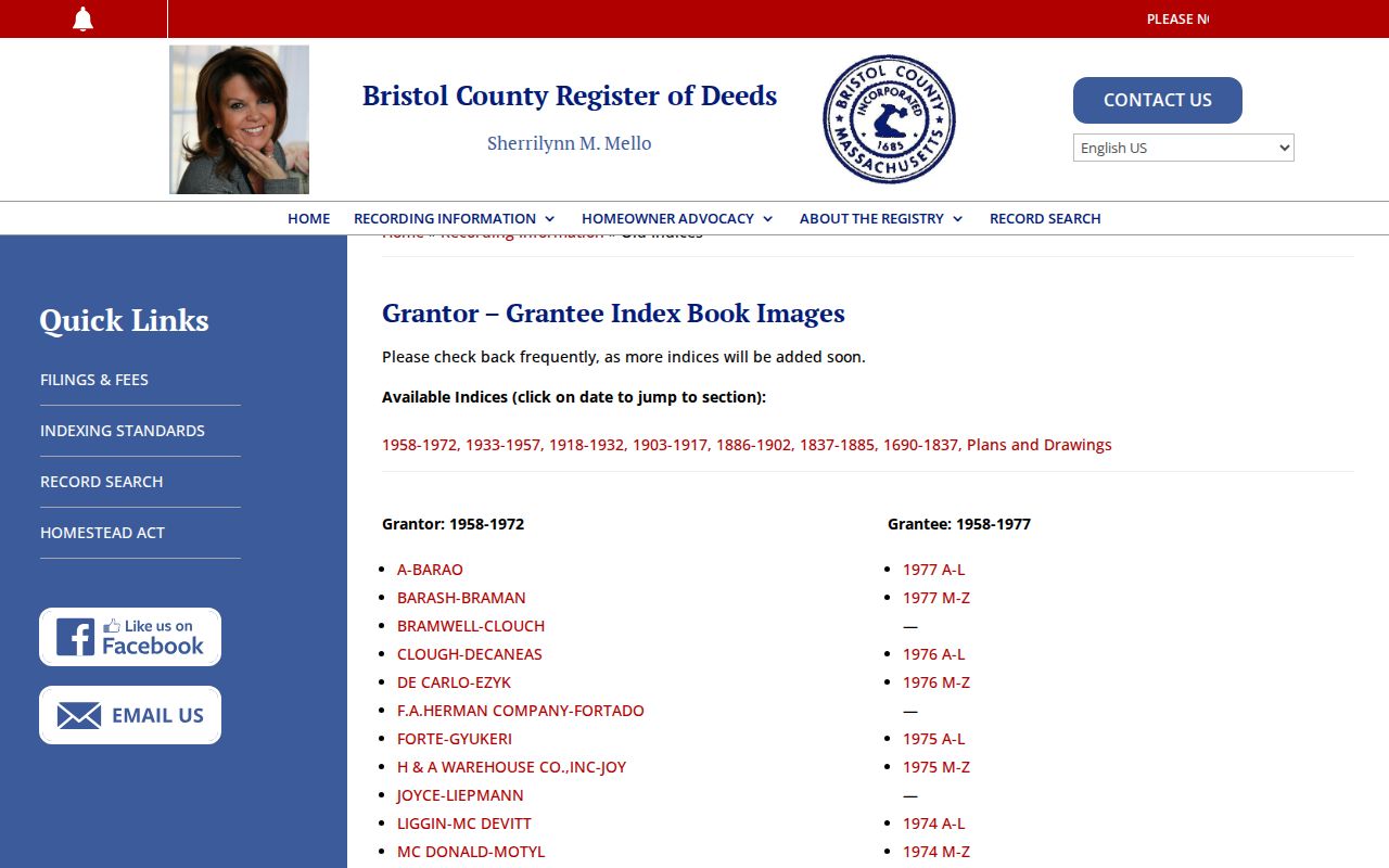
Older research is not covered by one continuous modern image system. Recorded-land images are available online back to Book 605, while the Registry’s scanned index books cover separate ranges: 1690–1837, 1837–1885, 1886–1902, 1903–1917, 1918–1932, 1933–1957, and 1958–1972/77. The scans identify parties and references for the next document check. Treat the absence of an address-text match as a reason to inspect the name and legal-description trail, not as proof that the parcel has no earlier record.
The Registry’s old grantor/grantee index collection is shown below.
The Registry’s web encumbrance list is not the official record. Its Certificate 13109 example did not display document 36720 because of back-indexing. Inspect the grantor/grantee index and actual instrument, then use the counter, copy center, or the Registry’s 2025 online account checkout when a copy is needed.
New Bedford Previous Residents by Year
Directory editions and census schedules become stronger when they are paired rather than read alone. The documented New Bedford directory run extends from 1836 through 1971 with gaps. Massachusetts state census years are 1855 and 1865, while public federal schedules span 1790 through 1950. A directory entry can provide a street and occupation; the closest census can supply a dated household composition. Both remain period evidence, not a claim that the same people stayed at the address between publications.
- Choose the directory edition nearest the target year and copy the printed page, scan page, name spelling, address, and any household notation.
- Pair an 1850s or 1860s entry with the 1855 or 1865 Massachusetts census where appropriate, then compare street, age, household, and occupation clues.
- For other eras, locate the closest public federal census from 1790–1950 and preserve its enumeration date instead of assigning a full-year residence.
- Use the next directory edition to test a move, name variation, household split, or a changed address, then return to the deed trail for the parcel link.
The dated volumes and street sections are described in the New Bedford Directory Book. The digitized 1836 New Bedford directory provides a direct scan route for the earliest listed edition.
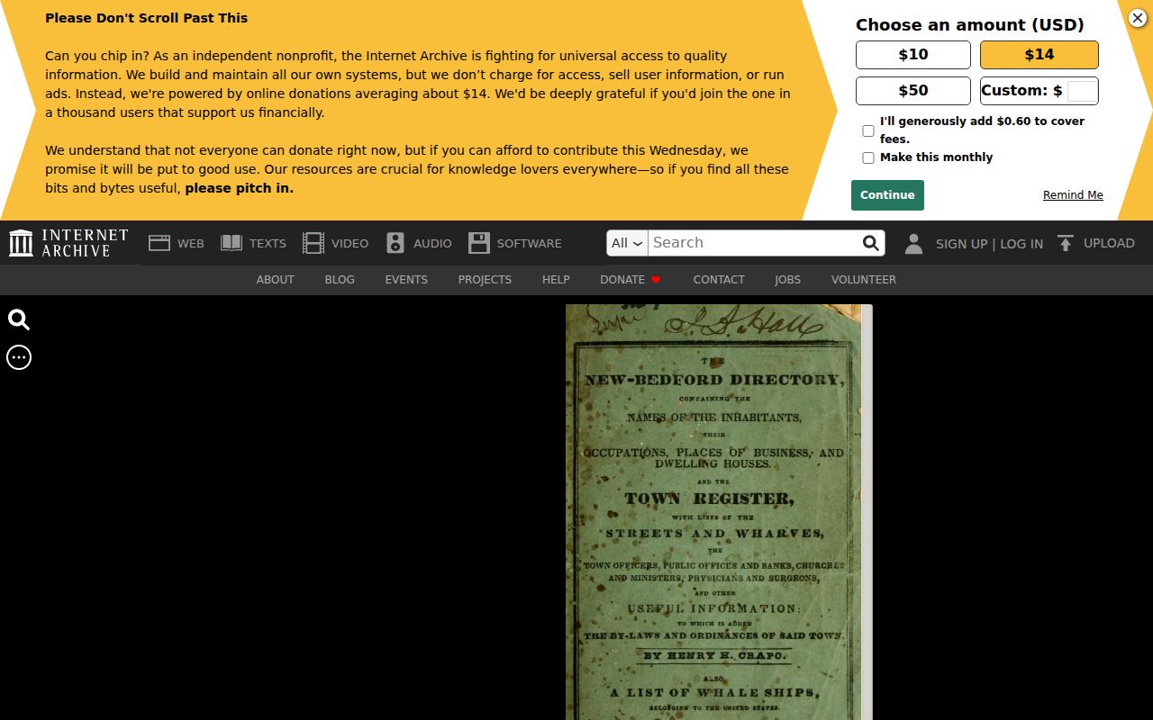
Reading the original scan matters because OCR can misread both names and numbers. Preserve the volume year, printed page, and scan page beside every historical address clue.
New Bedford Previous Residents on Maps
The Library of Congress Sanborn catalog identifies New Bedford editions for 1888, 1893, and 1906; the 1906 set contains 118 images. A Sanborn sheet can show a building footprint, use, street intersection, and numbering context. It does not name every person connected with the property. Use it as an era marker beside a directory or deed reference.
New Bedford DPI permit scans can add a later physical-change date. Their year and type folders may contain filenames with the address, project, permit number, or map/lot. If an expected file is missing, direct a defined address, permit type, and date-range request to the city custodian. The archive is evidence of available scans, not a complete permit index.
New Bedford Previous Residents Library Help
The New Bedford Free Public Library is the practical fallback when an address trail needs newspapers, directories, photographs, or local-history context. Its Reference Policy offers a free 30-minute quick search for special collections, area history, and obituaries. For newspaper copies, provide a specific date. The library estimates 5–7 business days for 1829–1968 newspaper work and 3–5 days for 1969 to the present, with three free obituary requests per person each year and $5 for later requests.
A focused request should give the street number, prior street name if known, approximate date range, and requested record type such as directory, map, obituary, newspaper, or photograph. The official sources did not locate a standalone house-history guide, so the reference service, Registry chain, and parcel record are the documented route. Local newspapers are held back to 1792 through the reference policy.
New Bedford Previous Residents Estate Trail
An obituary can supply the next careful lead when the parcel chain reaches a death or estate. The New Bedford Free Public Library’s Standard-Times index runs from 1968 to the present and gives surname, newspaper date, and page clues. Request the original page or consult the library’s holdings before copying a name relationship. That record can point to a Probate filing, but it should not be used to infer the person’s last address without another dated source.
From there, use the New Bedford Probate and Family Court and the deed record in parallel. A probate docket may identify a fiduciary, heir, or estate role; a later recorded estate conveyance may identify how the property moved. Adoption and sealed matters are restricted. This obituary-to-probate-to-estate route is useful for family history because it labels each relationship instead of assuming that all parties lived on the parcel.
New Bedford Previous Residents Numbering Check
The 1852 New Bedford directory street guide says that street numbers commence at a cross street and describes bearings from City Hall. That is a valuable nineteenth-century clue, especially where a directory gives a number with a cross street but no map/lot. It is not proof that every modern number follows the same rule.
No official citywide street-renumbering or renaming chronology was located. Mark a possible address change as unconfirmed until a deed, plan, historic map, assessor map, Sanborn sheet, or directory bridges it. Save the old spelling, alternate number, cross street, plan or lot, and ZIP alongside the modern parcel record.
Note: A changed number is a research question, not a conclusion, until two dated records connect the same land or building.
Past New Bedford Households, Carefully
Directories, census schedules, and obituaries add people to a time and place, but their meaning remains limited. A directory street section may list a historical address and occupation. A census has its enumeration date. An obituary is tied to its publication date. A recorded owner is a party to a land record. These records can corroborate one another, yet an owner should never be assumed to have lived at the address without dated household evidence.
For present parcel research by address, use the New Bedford Street Directory route first. For a backward trail, preserve source URLs, search inputs, image or page references, and retrieval dates. That makes later corrections and custodian questions possible without reconstructing a protected or uncertain identity.