
New Bedford Neighbor Source Routes
Public material around a New Bedford address is layered. Parcel systems describe land and assessment accounts, deeds describe recorded interests, and a municipal voter list is governed by election and privacy rules. Civic groups and historical resources can add context, but none creates a present-day roster. Start with the smallest source that can answer the question and retain its publication or retrieval date.
| Source | What It Shows About a Block | Access |
|---|---|---|
| AxisGIS | Parcel boundaries, owner and address search routes, property-card link, layers, and Abutter’s List entry point | Public map; displayed card fields can vary, and an owner is not necessarily an occupant |
| City parcel REST services | Parcel grid and plot/lot geometry for map-based cross-checking | Public technical service; schema and query details must be checked for each use |
| Bristol South Registry | Recorded ownership changes, instrument parties, plans, and legal relationships | Public index with image, account, copy-center, and old-index caveats |
| City Planning abutter file | Defined-project subject property, owner mailing information, applicant/contact, and notice context | Project-specific public workflow, not an ongoing block roll |
| New Bedford local voter list | Public local-list fields allowed by state access rules | Targeted request through election officials; protected fields and voters are excluded |
| Neighborhood United schedule | Public meeting geography, cadence, and civic contacts | Schedule only, never a member directory |
| Historical directories | Earlier occupants, street numbers, institutions, and adjacent businesses in a given publication year | Library, State Library, and digitized scans; historical snapshots only |
| Police or public-safety records | Date-specific incident or accident evidence when releasable | Request, eligibility, and redaction rules apply; no public block surveillance list |
Owner is not occupant. A property card may name an estate, trust, bank, or remote mailing contact, while a deed may name a grantor or grantee at the time of an instrument. Nearby residents who do not own land or are not eligible or public registrants will not be represented by those sources. Use “parcel owner,” “recorded party,” “historical occupant,” or “project contact” rather than a broad neighbor label.
Start New Bedford Neighbor Lookup
AxisGIS is the practical public starting point because its local guide supports type-ahead searches for owner name, address, and parcel ID. Enter the target address, confirm that the highlighted polygon corresponds to the intended site, and zoom until the parcel boundaries and street names are legible. Preserve the situs address, map/lot or parcel ID, and date of the map view before opening other records.
The map’s Layers tab can provide zoning, infrastructure, census, open-space, drainage, and related geographic context. Street View and Bird’s Eye View are visual orientation tools, not proof of ownership or occupancy. The CAI Property Card is useful for the selected assessment account, while the Abutter’s List tool is the appropriate map feature when a defined project requires nearby-owner notice information.
A selected parcel is a land unit, not a household boundary. Multi-unit, institutional, waterfront, and commercial sites can have one owner record alongside many historical or project-related names. Treat the polygon as the beginning of a documented land search rather than a conclusion about the people on the block.
New Bedford Neighbor Owner Trail
For nearby parcels, use the visible boundary pattern rather than an unconfirmed radius or buffer. The reliable block flow is address, highlighted polygon, adjoining parcels, property card, Registry confirmation, then a dated role label. It remains useful even where an adjacent polygon has no visible name because the parcel ID can bridge the map and the assessment or deed record.
- Find the target address and verify the highlighted parcel polygon, street, and map or lot reference.
- Click each adjoining parcel rather than assuming a distance-based set of neighbors.
- Open the property card or use the parcel ID to record the assessment owner and mailing role if displayed.
- Search the identified owner as a grantee in the Registry and inspect the instrument’s date, book/page or document number, and legal description.
- Label the final note by its evidence: nearby parcel owner as of source date, recorded party, planning contact, or historical street entry.
The Registry is the confirmation step because an assessor map and a recorded instrument describe different events. Southern Bristol covers New Bedford, Acushnet, Dartmouth, Fairhaven, and Westport, so record the municipality and legal description rather than assuming every result belongs to the city. For a full named-street sequence, use the New Bedford Street Directory workflow instead of extending this block method beyond adjoining parcels.
New Bedford Neighbor GIS Check
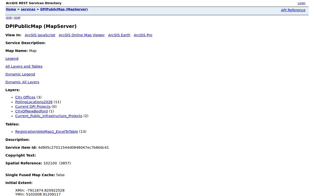
The city’s DPI Public Map REST service exposes city offices, polling locations, current projects, city boundary, infrastructure projects, and a registration-vote table. The service offers Query, Find, Identify, and Export Map operations. These are map-service functions for checking geography and public layers, not a claim that every layer provides a person-level block list.
Parcel Grid and Parcel Plot/Lot services are separately available in the city Parcel folder. Identify can help test the selected location; Query and Find can narrow an existing layer; Export Map can preserve the current visual context. Check the layer description and fields before relying on a result, because the public source did not establish a single street-buffer parameter or a confirmed name-returning neighbor query.
The public service reports a maximum record count of 2,000. That ceiling means a broad result can truncate, so a geometry or layer-based check must be narrowed and its completeness questioned. It is safer to inspect adjoining polygons one by one than to present an unverified bulk extraction as complete coverage.
The official REST directory is a starting point for the city’s mapped layers and their available operations.
New Bedford Neighbor Abutter List
New Bedford’s public planning application separates a subject property’s map number, lot, and address from the owner’s name and mailing address. It also records an applicant or contact and the review reason, such as Planning Board, ZBA, Conservation Commission, Licensing Board, or another stated category. That separation is a useful model for keeping site, owner, and contact roles distinct.
The AxisGIS Abutter’s List action and City Planning application workflow are appropriate when the question concerns a defined notice area or project. An abutter list does not establish a permanent community directory and should not be extended into claims about every person near a parcel. The research located an official example with a $5 abutter-list fee, but the current fee and production method should be confirmed with City Planning before relying on it.
Keep the project date, address, map/lot, board reason, and document source alongside any return. That makes a planning contact traceable to its stated project rather than to an assumed personal connection with the neighborhood.
New Bedford Neighbor Voter Limits
Massachusetts describes public local voter-list fields including name, address, party, date of birth, active or inactive status, and some registration or election-history information. A local list can be requested from New Bedford election officials under election law and the Public Records Law, with production and redaction rules. Specify the date, requested public fields, and output format instead of asking for a vague block roster.
The Secretary’s online form is different: it asks for one person’s first and last name, full date of birth, residential ZIP, and an agreement checkbox. It is not a map or street-wide search. A non-match in that form does not establish nonresidency, and a match does not describe every person attached to an address.
G.L. c.51, §47C restricts the statewide central registry. Phone, email, veteran status, permanent-absentee data, confidential voter information, and minor pre-registrant information are outside the normal public fields. The city GIS polling and registration-vote layers show civic geography, not an open list of everyone on a block.
New Bedford Neighbor Meetings
Neighborhood United’s April 2026 schedule is a civic layer for New Bedford neighbors, not a membership roll. It states that public neighborhood meetings invite residents and include City Hall, police, City Councilors, and others. Its value is showing where an association meets and how a person can use the schedule’s published contact route for a respectful civic question.
| Neighborhood United setting | Meeting place | Appropriate contact route |
|---|---|---|
| Ward 2 | Wilks Library | Use the published schedule contact for public-meeting information |
| Cove Street | Howland-Green Library | Use the schedule for meeting context, not household names |
| Ward 5 | Buttonwood Senior Center | Use the listed civic contact and meeting cadence |
| West End | Carney Academy | Ask about public meeting information only |
| AJ Gomes | AJ Gomes School | Use the schedule’s published route for civic context |
| Clarks Point | Waste Water Treatment Plant | Refer to the current schedule before attending or contacting |
| Acushnet Heights | Parker St. School | Use the association’s public meeting details |
Taber Mills and Olympia Towers are identified as resident-only groups, so their inclusion in the schedule does not open their membership information. Ward 3 is marked as having no meeting until further notice. These status notes are precisely why public meeting geography should be dated and never turned into a claim about group membership.
Historic New Bedford Neighbor Clues
For an earlier block, start with a city directory’s street or criss-cross section. Find the street and number, transcribe the name shown, then use the alphabetical section for occupation, spouse/status, or another address clue. Match the directory year to the printed page and scan, because OCR can misread both names and street numbers.
The 1836 to 1971 directory runs provide historical snapshots, not current residency findings. Pair a street entry with a deed recording date, census enumeration, obituary date, permit, or map before suggesting continuity. Historic New Bedford maps, including the 1888, 1893, and 1906 Sanborn sets, can provide street intersection and building-footprint context without identifying a modern household.
The New Bedford Historical Society at the Nathan and Polly Johnson House preserves and interprets regional contributions of people of color, while the Whaling Museum’s eMuseum provides object-level context from photographs, manuscripts, logbooks, and local industry. These institutions enrich a neighborhood story without supplying private rosters.
New Bedford Neighbor Tool Comparison
Official parcel, deed, local voter, library, and planning sources make it possible to identify the custodian, date, field, and access limit behind a result. Each source has a defined role: the parcel record describes assessment context, a deed records an instrument, a voter list has legal boundaries, and a library directory fixes an historical snapshot. That traceability is the reason to begin with the original record system.
Anonymous commercial neighbor tools may combine property, directory, and other fragments into inferred household associations. Their coverage, update cycle, accuracy, correction process, and opt-out mechanics can vary, and an inferred association should not replace a dated public record. A category-level result without a custodian or source date is not a substitute for a local document.
Keep the source date. A parcel owner can change after a map refresh, a planning list belongs to a project, and a directory belongs to its publication year. Dated role labels prevent a temporary record from becoming an unqualified claim.
New Bedford Neighbor Privacy
Not every nearby person appears in a public source. Occupants who are not owners or public registrants, minors, ACP participants, protected voters, phone and email data, utility customers, delivery information, motor-vehicle addresses, sealed court participants, and non-public case or license details remain outside this work. A parcel map cannot be used to fill those gaps.
Massachusetts Safe at Home provides a substitute address and mail forwarding for qualifying Address Confidentiality Program participants. G.L. c.51, §47C restricts the statewide voter registry. Do not attempt to reconstruct a protected address from maps, relatives, historic directories, or a planning document, and ask the relevant custodian to correct an actual record error.
Lawful use. Neighbor research can support civic participation, local history, a property question, or respectful reconnection. Stalking and criminal harassment are addressed in G.L. c.265, §§43 and 43A; never use a public record to watch, intimidate, or expose another person.